Dick drove, and we stopped for breakfast at McDonalds before getting to the hangar. We did a careful preflight inspection, hauled the plane out of the hangar and did a gear check to make sure we had all our stuff – note cards, charts, iPads, headsets – let’s go!
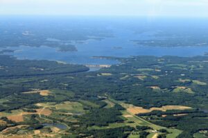
I got in the left seat for the first leg out to Martinsville (MTV). We made our takeoff from runway 4 at Suffolk with calm winds. It was a very clear and calm day and we climbed smoothly to 4,500 feet for the trip, enjoying the spectacularly clear day. Outside air temperature was noted as only 60 degrees at altitude – very nice. We checked in with Norfolk Approach and got flight following for the trip, as we were going to be in the air for roughly an hour and a half, and settled in for the ride. Dick was enjoying the scenery, as we could easily see Lake Gaston and the Kerr Reservoir to our south. We got a few nice photos of the Kerr Dam.
The airport was easy to spot, and we entered the downwind leg for runway 12 at the 45 and landed shortly afterwards. It is a nice airport with a 5000 by 100 foot runway, so it was not a great challenge. OK, one landing down, many more to go. The terminal was very nice, but the café was not open and Jason Davis, the airport manager, said there was no current operator, although he hoped there would be soon. After collecting our stamps and refreshing ourselves with nice cool water available in the terminal, we got back in the plane with Dick in the left seat this time.
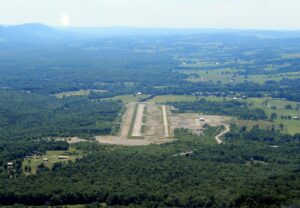
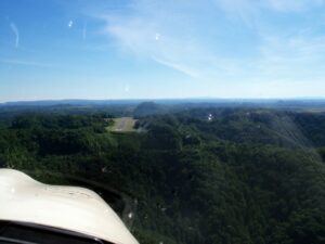
We had a short hop to Twin Counties (HLX) in the Galax-Hillsville area. The scenery became much hillier, with rolling green pastures and treed hills. It was obvious we were going to have to scour the countryside if we wanted to find this airport, and we did. We knew from the Garmin that we were very close, but could not see the field. Then suddenly it appeared on the right wing. We were just far enough out for Dick to make a smooth right turn back onto a left base leg and the left onto a short final for a nice landing. There wasn’t much there. We got our stamps and headed back out to the plane to get moving on our next leg to Mountain Empire. Two down, 20 to go!
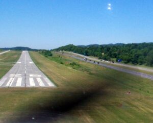
I got in the left seat again. The weather remained beautiful and virtually windless. We departed on runway 1 and turned out to the left for about a 20 minute leg to Mountain Empire (MKJ). The airport was just on the east side of Interstate 81 and was easy to spot as we bent our approach a bit to the northwest to follow the interstate down for the last couple of miles. A straight in approach got us down nicely on runway 26, which was an uphill runway. The airport manager, Brian, met us as we walked to the terminal and offered us his hospitality, which included use of the loaner vehicle. He also 100LL for $4.95/gal, cash! Outstanding! We drove about a mile from the airport to The Barn Restaurant for a very nice burger for lunch. After refreshing ourselves at The Barn, we returned to find the plane gassed up and ready to go again, so we hopped in.
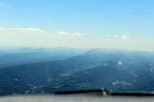
Again, I took the left seat, as the previous leg was pretty short, and Dick wanted the honor of landing at Lee County airport after our next stop. We elected to takeoff downhill on runway 8, and made a sweeping left turn out to get back on our southwesterly course of 255 magnetic to get to Virginia Highlands (VJI) airport in Abingdon. The trip was another pretty one, with crystal clear views of the valley below us and the mountains on both sides. It had begun to warm up a bit, so some thermals were beginning to bump us around a bit, but nothing too uncomfortable.
Virginia Highlands was another airport running parallel to I-81, this time on the west side of the highway. We landed on runway 24 with a slightly downhill slope, and made our way into the terminal. It was another nice, quiet place, so we collected our stamps and wanted to get underway again quickly. We were on our last leg to the west, heading to the airport farthest to the west, Lee County (0VG). We had about 57 miles to go, with some spectacular views.
Dick lifted us off runway 24 from Virginia Highlands, starting us off straight out for our destination in the pointy end of the state. We continued down the valley for a few miles before crossing some mountain ridges to our west. We then followed the North Fork of the Holston River on the east side of Clinch Mountain to Gate City where we made our way west, rounding the south end of Clinch Mountain. We gradually made our way southwest, crossing several parallel mountain ridges to get to the general vicinity of Jonesville. From there we bent our course more to the west as we got the airport in sight. It was a large facility with a nice east – west runway. We rounded the east end of the airport and entered the downwind leg for runway 7.
Dick got us smoothly on deck, and taxied to the terminal, which was closed and locked. No worries – a sign directed us to the pilot’s lounge on the end of the building, using the CTAF frequency as the combination to get in the gate and the lounge door to the terminal. We attempted the code several times with no success until we realized there was a * to be used at the beginning of the number string to be entered. Then we were in. We refreshed ourselves in the air conditioning (although it was not uncomfortably hot outside) and reviewed our notes and plan for the rest of the afternoon. We did not find a stamp there. On reviewing our notes which indicated it was in a box on the side of one of the hangars a few hundred yards down the taxiway, we took off in that direction.
As we made our way in that direction, we stopped to chat with a couple of fellows attempting without success to gas up their motorcycles at the fuel ramp. On our way again, we were intercepted about halfway to the hangar by a fellow who was working on his plane there, who also turned out to have grown up in the Hampton Roads area. We chatted for a good while, and he advised us that the stamp was actually in a mailbox next to the main (locked) door to the terminal. He offered us a ride on his pickup, but we decided to walk anyway. We got our stamps and took a final look around the place, and got back in the plane. All tolled, we had spent about an hour at the Lee County Airport and began to feel that we were slipping behind on our timeline.
I was in the left seat for this leg. Our destination was Lonesome Pine (LNP), about 38 miles to the northeast in Wise County. We departed runway 7 on a leg in about the right direction straight off the runway. It wasn’t all that long a flight and the terrain below was beautiful. We climbed out to 5,500 feet and marveled at the beauty all around us, particularly as we flew past Big Stone Gap and some of the large strip mines around Appalachia and Indian Mountain.
The airport came into view with little difficulty, and had a distinctive water tower to the east of the field. Again, the runway orientation favored us with a straight in approach, and we landed without ado on runway 6. We taxied to the terminal and walked in to get our stamps. Since we had spent so much time at Lee County, we did not dally here, accumulating only 10 minutes on the ground. We realized we still had four more stops before our day was finished.
Our next stop was perhaps the most distinctive of the trip: Grundy (GDY). Grundy is a little airport roughly on top of a mountain ridge with a drop-off on each end. To be precise, you want to land neither too short nor too long. The runway is 2256 feet long, but it looks a whole lot shorter on final approach and even shorter after you have touched down a little longer that you planned. Which we did. The plane just did not seem to want to settle until it was just about go-around time. Finally the wheels got down and we braked hard and stopped in time, with several inches left to spare. As we taxied to the ramp, we saw a few fellows sitting under a pop-up canopy with 10 or 12 remote controlled airplanes. We made our turn-around so that we did not blow all their gear across the fence, and then shutdown to collect our Grundy Municipal stamp.
We climbed out and chatted with the R/C flyers for a little bit, remarking on the hulk of another Arrow on the apron as well as another hulk on the south side of the field. Then we made a short walk down to the hangar office that housed the coveted stamp. It wasn’t much of an office, but it was enough and we had no trouble finding the stamp, making sure to get a good imprint, as we suspected we would not be back to this airport again. Looking back at the experience, perhaps we will.
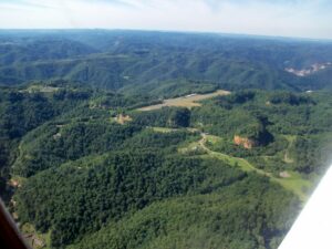
We didn’t fiddle around long there, and I got back in the left seat. After a brief taxi and run-up, we executed a short field takeoff, just to be sure, and then doubled back on our crosswind leg to get a good view of the field, and then made a wide, sweeping turn to the right all the way around the field to get a few good photos. The photos we studied prior to our departure on this trip did not do the field justice, as it was indeed remote and perched on top of a ridge. A very impressive sight from the air!
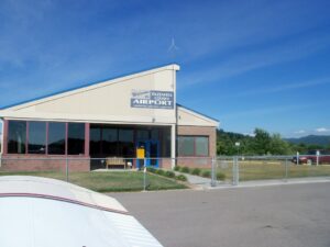
After our aerial photo tour of the airport, we made our course southeast toward Tazwell County (JFZ). It was another beautiful flight in the mountains, crossing several ridges on the way. The airport soon came into view and we turned back to the east to make a straight in approach to land gently on runway 7. Tazwell is a fairly new airport, and the terminal and facilities looked very nice. From the outside. We had arrived after closing and the place was locked up like Fort Knox. There was no open entrance, so we began the process of taking pictures of ourselves in front of the terminal to document our having been there. We began walking around the building looking for a possible box containing the stamp, as many of the other airports we had visited had them located in anything from mailboxes to coffee cans. No joy here.
Just as we were about to declare defeat, a red pickup truck approached and parked next to the terminal. Could this be someone who could get us into the terminal for a stamp? The door opened and a fellow got out and asked if he could help us. Dick indicated that we would be most grateful if he could get us into the terminal for just a moment to get our airport stamp. He stated that he could do that, and could offer us a cold bottle of water too. He introduced himself as Jim French, the manager, and that he had only left about 20 minutes before, but had forgotten his cell phone and was just returning to retrieve it. We were delighted that he had chosen this particular day to be forgetful, and were only too happy to take him up on his offers.
Jim was as good as his word, and he opened the terminal and invited us in. He got the stamp out of a hidey-hole in the counter and stamped our passport books. He got some icy cold bottled water out of a refrigerator and handed it to us as we chatted. We each took a bathroom break and a tour of the terminal, which was virtually brand new and had some nice facilities, including a couple of comfortable lounges and some interesting photos and models around the building. After a while, we realized we were burning daylight and had been chatting with Jim for about half an hour. We reminded him not to forget his phone again as we began heading out the building and back to the plane. Among other things, he told us we would likely find our next destination, New River Valley (PSK), closed for the night as well. We both hoped the stamp would be outside in a box somewhere as we got strapped in for the next leg of our trip.
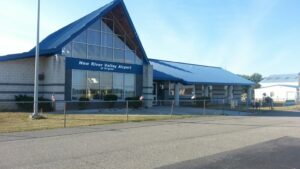
Dick was in the left seat for this leg. Our course took us easterly to a point a couple of miles from Mountain Empire (MKJ) airport to allow us easy clearance of some high spots, and then northeast to Pulaski and the New River Valley airport near Dublin. Again we were treated to spectacular mountain views with the late afternoon sun behind us. We easily sighted Mountain Empire as we shaped our course back to the north, and followed the valley to New River. I remembered camping in this area several times almost 40 years ago when I was a Boy Scout, hiking through some of this beautiful mountain country. We soon sighted the airport and we were looking almost right down runway 6. It looked quite large, and it was, as one of the largest runways we would land on during our trip: 6,201 x 150 feet. Dick lined up for a straight in approach and greased her down gently, easily making the first turn-off to the terminal.
Well, our luck finally appeared to run out. We checked the terminal and found it locked tight, and we also spied the stamp sitting on the counter inside. Unless we got really lucky again and someone showed up to let us in, we were going to have to make do with photos this time. A friendly fellow pilot showed us around a bit, and confirmed our suspicions – the place closed about half an hour before we got there and it was all locked up. He agreed to take our photo outside to provide us with documentary evidence of having visited. He also told us that the Virginia Tech/Blacksburg (BCB) airport would be closed at this hour too. We were disappointed, but a strategy began to develop in our minds.
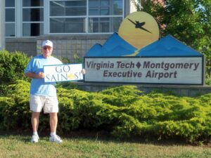
We realized that Virginia Tech was our last stop before ending our day in Roanoke. Total flying time remaining for the day was minimal, so we decided to visit Tech, just in case, and then proceed to Roanoke for the night. Then in the morning, we would back-track to New River and then Blacksburg to “tag up” and get those stamps before proceeding on our second day’s itinerary. So we got back in plane, and I took the left seat for a scenic flight and approach to Virginia Tech, landing on runway 12. On checking the terminal, we did indeed find it locked, so we took some photos and departed for the evening, with Dick flying the final leg of the day.
It was a short flight to Roanoke (ROA) – only about 15 minutes. The early evening views were still quite spectacular, as the sun was still shining. We contacted Roanoke Approach and got vectored in to runway 6. Winds were, as they had been all day, virtually calm. Dick guided us in to a very nice touchdown on target and right on centerline, turning off the runway at the first turnoff. Ground taxied us to the Landmark Aviation ramp and we parked in an open spot and shut down. The flying day ended at 1939 with exactly 500.0 on the Hobbes. We completed our notes and figuring for the day and gathered our gear for the night and got out of the plane.
At this point, we were a bit surprised that no one had come out to greet us to help chock and tie down or ask if we needed any services, etc. We re-spotted the plane a bit to center it on the “T” and tied it down. Then picked up all our bags and ambled into the terminal, where there were a few people milling around, but no one seemed in a hurry to see who we were or what services we might need. Dick stood at the counter until recognized and announced our presence and suggested that someone might place some chocks on the plane and that he’d like to fill up with gas before departing in the morning.
We asked for some information on local hotels and received a list of choices, from which we selected a comfortable sounding place nearby. We made use of a computer in the pilot’s lounge to reserve a room and made a quick check on the weather for the next day, just to verify we had nothing unexpected developing. Then we asked the desk for a ride to our hotel, which they happily provided. The place was literally “just around the corner” so we were there in no time and checked in.
While checking in, we inquired about a shuttle or van to take us to someplace to eat, and were informed by the lady at the desk that there was a shuttle and that she could call it in any time we wanted. We looked at each other and decided we could be ready in about 20 minutes, so we requested a pick-up then. We headed off to our room to get ready, quickly showering and changing into something not as, er, “fragrant” as our flying togs. We also did a quick iPad and GPS track review of our day’s trip and were very pleased with the results. We had visited eleven airports between our departure from Suffolk before 0900 and our landing at Roanoke just after 1930.
We headed down to the lobby and asked Brenda, the desk lady, to call the shuttle for us. We inquired about local places to eat, and were informed of the usual collection of restaurants to be found near a large shopping mall. We selected Carabbas from the list, and were deposited there by the shuttle, with instructions on how to call for a return pick up. After a delicious (and filling) ribeye steak dinner, we returned to the hotel quite ready for bed, but we had just a little more planning to do before departing the next day.
We made good use of the free wi-fi to get an updated weather briefing and to review our itinerary. We included a back-track to New River and Blacksburg in the beginning of the day, followed by our original route to Ingalls (HSP), Eagle’s Nest (W13) and beyond. On reviewing flight times, we decided to remain flexible as to whether we would stop at Culpeper, Warrenton and Shannon on the final leg home, as Dick had an appointment in the afternoon. Dick did not need to stop at those airports anyway, so we agreed that if we could not get to them on this trip, we would make a follow-up trip soon after so I could collect them and finish getting my stamps. Then we went to bed, both of us falling instantly asleep.
