The alarm went off at 0545. As I was used to waking up at 0400, this wasn’t as rude an awakening as it was for Dick, although he didn’t hear the alarm but heard me stirring as I awoke. We got up, performed the usual morning ablutions, packed our bags and went downstairs for the complimentary breakfast. As it was just a shade after 0600 when we got there, and the place opened at 0600, we were the first customers. The buffet was prepared but all the lights were not on in the dining area, so we had to turn them on. As we had our eggs, sausage and muffins, Dick tallied up the flight time on each leg of the trip from the previous day: 6.1 hours.
After finishing breakfast we went back up to our room, made a final weather check online, a final bathroom stop and grabbed our bags and headed down to catch a shuttle to the airport. The desk clerk summoned the driver and we were on our way. When we arrived at the airport, we were again greeted by an empty desk. We heard a couple of fellows back in the office area discussing some flying adventure or another, but it turned out they were also getting ready to depart and were not part of the staff. Eventually, Dick went outside and found someone in an office in the hangar behind the terminal and he came out to check us out. He verified that the plane had been fueled and that we were ready to get going. We were already behind our planned schedule and knowing we had to go back to New River and Blacksburg, we wanted to get on with things.
We toted our bags out to the plane, untied and unchocked and did a preflight after stashing our bags. Fuel was nice and full and Dick put half a quart of oil in the engine. We got in with Dick in the left seat and fired up. After a check of the weather on ATIS, we got clearance and taxi instructions from ground. We were directed to runway 34, and after our run-up checks were complete we got clearance for takeoff and were were on our way. After a left turnout we were pointed back to the southwest to go back and pick up the stamps we missed the day before at New River and Blacksburg.
The morning scenes were beautiful with fog and mist in the valleys. We had been watching the weather at our next two stops and saw that Blacksburg was fogged in, so we decided to proceed to New River first where the report was clear. We passed Blacksburg on our right side and looked things over as we went by and saw that the airfield was clearing with some quickly dissipating mist still visible. By the time we got done at New River, we would be fine getting into Blacksburg.
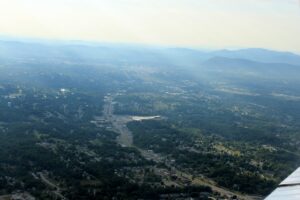
We landed at New River and shut down in the same spot were used the previous evening. The terminal was open this time, so we marched right in and got our stamps, with only the briefest of chats with the two fellows there. We felt a lot better knowing we actually had the stamp and not just a photo in front of the terminal. We took off and headed for Blacksburg after verifying the weather there was as we expected: clear and sunny. On the way, we noticed a pillar of light-colored smoke, which would be just to the right of our track. As we got closer we could see it appeared to be a fire in a barn. We put it just off our right wing, avoiding the smoke, and looked it over closely as we passed by but could detect no flames. Perhaps it was a large smokehouse? Or maybe a smoldering fire? We couldn’t tell and saw no emergency vehicles on scene, but as we landed a few minutes later we could see some fire vehicles headed in that direction.
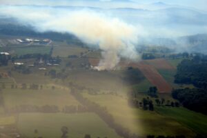
Burning barn near Blacksburg. Smoke from this had spread all over the valley and was quite evident over the airfield too. (click to enlarge)
Dick landed us smoothly and we turned directly in front of the terminal and shut down. There were a few people inside discussing a flight they were getting ready to make as we got our stamps. Soon a fellow walked in with some breakfast for the group and we got involved in a conversation with him. He owned a large automotive dealership group in the area, and was getting ready to fly out to Chicago on his jet. It turned out that his son raced funny cars and had a record of 326MPH in 3.95 seconds on a 1000 foot drag strip! Wow!
It was time for all of us to go, so we made our goodbyes and headed back out to the plane. I got in the left seat this time for our flight to Ingalls Field (HSP) at Hot Springs, VA. After getting started and taxiing to the west end of the runway, we heard the jet call that he was on his way to the other end. We elected to hold short and let him take off first so we could watch him go before we took off from the other direction. He lifted off about halfway down the runway and climbed smoothly out on his way to the northwest. Then we taxied onto the threshold and took off to the east, leaving smoky Blacksburg behind us.
We had reviewed our track for the next leg, and realized we had a couple of options on how to proceed to Ingalls due the mountains. We elected a more direct route from Blacksburg, following just east of a 3600 foot ridgeline until we got to Clifton Forge, where we ducked through a gap to the west. Just as the day before, we were treated to magnificent mountain panoramas. The mountains in this particular area were really beautiful. As we headed west through the gap, we could see Lake Moomaw in the distance before bending our course back to the northeast to enter the pattern for Ingalls Field.
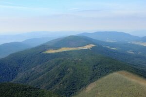
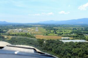
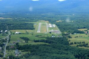
This airport was at the greatest elevation of any airport we would visit in the state: 3,793 feet. We sighted it fairly early on the mountain top, not really thinking that was really the field. However as we got closer it became obvious that it was indeed the airport. We entered on the downwind leg for runway 25 and after turning on final we were presented with a fantastic view of the airport on the mountaintop with scenic valleys on both sides. After a gentle touchdown we taxied to the terminal, where Becky, the manager, met us to ask if we needed any services. We told her all we needed was an airport stamp, but we gratefully accepted her offer of some cool bottled water. We also availed ourselves of the restroom.
While we were there, another couple of planes had arrived; one a jet with some passengers, and a Cessna 172 painted in the livery of the Civil Air Patrol. Dick discovered he needed some new batteries for his camera and stalked back inside to see if Becky had any. Meanwhile I assisted the husband (Paul) and wife crew of the CAP plane in obtaining a photograph of themselves in front of the terminal. During our conversation we discovered that we were on the same mission to gather airport stamps, and that they were from Chesapeake, right down the road from us. They had already been to our next destination, but it looked like they had others on their itinerary that we would visit, and we assumed we would see them again before the day was out.
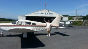
Well, we were refreshed and Dick had some new camera batteries, although they turned out to be duds and he went back to his old batteries for a while. He took the controls as we started on our next leg, back to The Valley for a visit to Eagle’s Nest (W13) in Waynesboro. Eagle’s Nest is the shortest public use runway in the state at a skimpy 2004 x 50 feet. We had a little difficulty finding the airport until quite close, but Dick easily slipped us into the downwind leg for a very nice landing on runway 24. This might be the shortest runway in the state, but it felt downright generous after our landing at Grundy the day before!
The folks in the terminal were very friendly and got us our stamps, also offering us the hospitality of some water and bathrooms. We chatted briefly and discussed their proud status in having the shortest runway in the state but the warmest hospitality. We agreed. Then it occurred to us that Dick had completed collecting the last stamp he needed at Ingalls and we completely missed it! No celebration, no whooping and high-fiving. Nuttin. So we whooped it a little bit and slapped high fives and took some more pictures here at Eagles Nest to celebrate. He decided once might not be enough, as some of the conversation had involved another pilot who had gone around a few times collecting stamps, so Dick got a new book right there and started over. Whoopee!
The next two legs were going to be very short, Shenandoah Valley (SHD) in Staunton and Bridgewater (VBW), so I would be in the left seat for both. After exercising a short field takeoff and climbing out to the left, we very easily spotted the airport to the northwest. The field was another huge airport with a 6000 foot runway 150 feet wide. We were already set up for a nice 45 degree approach to the downwind leg of runway 23, so we entered the pattern and landed with plenty, and I mean PLENTY, of runway to spare. We were not surprised to see our new CAP friends from Chesapeake on the ramp as they were getting ready to depart.
We taxied to the terminal and went inside for our stamps, Dick now on number two in his new book. The terminal was manned by a security guard who was very friendly and provided his advice on landing at Bridgewater, a public use airport under government contract for a variety of uses, some of them a bit hush-hush. The guard said there wasn’t anyone manning the terminal on Sunday, so we would probably not reach anyone by phone (we had already tried), but a security guard would meet us and we would be able to get our stamps without much fuss. Dick also asked if he had any batteries for his camera to replace the two sets of duds he had, and was rewarded with a fresh pair. We thanked him for his advice and the batteries, and after a quick photo or two in front of the terminal, we strapped back in and headed out to Bridgewater, about eight miles away.
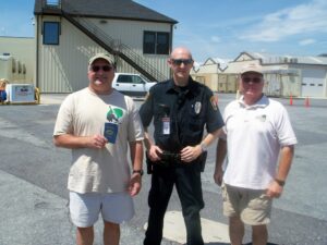
After leaving the pattern at Shenandoah, we were looking right down runway 33, so I made a straight-in approach. As we were about 5 miles out, we tried calling on CTAF to arrange with the security guard for our business, but received no answer. We landed and taxied to the ramp near the terminal and parked right next to our CAP friends’ plane, as we had seen them walking in search of the stamp. As we taxied and shut down, we saw the security guard driving in to meet us, so we debarked and stood by as he approached. He was very friendly and, and said it was no problem to get a stamp from him, but he would have to go back to his office to get it. He suggested we stay with the plane, which we were more than happy to do, and when Paul, the CAP pilot and his wife hove into view we let them know what was going on. Soon the guard returned with the stamp, getting all our books imprinted, and then posed for photos with us.
We then got back in the plane with Dick in the left seat this time for our hop to New Market (8W2). The CAP plane taxied to the other end of the runway and departed from runway 15, but we elected to wait for them to go so we could exit using 33, headed in the right direction for our trip to New Market. With almost no wind at all, there wasn’t anything else preventing us from doing this. As we did run-up checks we watched the CAP plane pass to the east of the field on its way to New Market ahead of us. We took off and started on our way, keeping an eye out for them as we knew we were headed the same place.
The flight was beautiful as we flew down the Shenandoah Valley (the river runs north, so technically the “down” end of the valley is to the north), and it was starting to get a little bumpy as the thermals began to build. Nothing uncomfortable, but something we had noticed the day before too. We did hear “CAP3545” make a few calls, and we scoured the sky to find him and finally did, well below and forward of us. We easily maintained a generous spacing as we watched him land while we were just turning to base for our own landing on runway 24. We shut down at the little terminal and saw a bustle of activity there as the skydiving shop was in the full swing of business. We were cordially invited in and were shown where the stamp was so we could get to business. I availed myself of the restroom, only to find the urinal almost too tall for me to reach. It must be a test for those wanting to skydive – if you are not tall enough to pee here, you are not big enough to skydive. Fine with me!
As we started up, the skydive plane landed and taxied to the terminal, picking up a load of skydivers without shutting down. We let him go ahead, and soon he was airborne in front of us as we waited to back-taxi to the threshold of 24. After doing run-up checks, I again executed a short-field takeoff, partly for practice and partly to make sure we easily cleared the tall silos off the end of the runway. We had no difficulty clearing them, and a left turnout put us on course for Luray (LUA), our next stop.
The flight was short, but we had to climb to pass through New Market Gap in Massanutten Mountain to Luray on the other side. We had no trouble reaching the gap comfortably, and on entering it, got a nice upsurge from the deflected breeze from the southeast. Once on the other side, we descended fairly rapidly to get to pattern altitude. We chose runway 22 for our landing, which required right traffic, but otherwise wasn’t remarkable. After landing and taxiing to the terminal we hopped out as we watched our CAP friends taxi up and shut down next to us. We quickly got stamped and got back in the plane to get ahead of the CAP plane to create some more separation, as they would be following us the rest of the way today.
Dick got back in the left seat for the next leg to Front Royal (FRR), our next to last stop before heading back to Suffolk. As we followed the South Fork of the Shenandoah River northward, the thermals increased and we had a bit bumpier ride than before. The trip wasn’t very long, and we again found ourselves scouring the terrain for the airport. Dick had been here before and had an idea what to look for, but still we managed to sneak up on it before we spotted the runway. Luckily it was right where we needed it, and Dick entered the downwind leg of runway 28 and soon had us on the ground, taxiing past a row of gliders waiting to be used. The terminal was quiet, with a couple of fellows sitting outside the south entrance. We went in and got our stamps (self service) and headed back to the plane.
Our next stop was Winchester (OKV). Winchester is a pretty good sized airport, and we could spot it almost as soon as we left the pattern at Front Royal. We would stop there for a break, get gas and update our weather information before making the hour and a half final leg back home. Our approach from Front Royal had us on a nice 45 degree entry for the downwind leg of runway 14, which was nice, as the traffic we heard on the CTAF indicated the 14 was the runway in use. We landed and taxied to the terminal and shut down. Inside, we were greeted by a friendly lady at the desk, and she provided us with our stamps, initialing and dating our books for us. We made a final restroom break before the final leg, and reviewed our weather and other information. The we made ready to go.
We taxied the plane over to the fuel ramp, and after squinting and shadowing the card reader display with our hands so we could see the dimly lit instructions, we finally got the pump turned on and filled up the plane. Dick offered me the left seat for the final leg, which I accepted. We departed on runway 14 and headed onto our final leg of the journey. We climbed our way out to 3500 feet, passing through the gap in the mountain ridge transited by Route 17 as we exited the Shenandoah Valley. We made our course about 165 degrees magnetic, passing just west of Warrenton and Fredericksburg and east of Richmond. We checked in with Potomac Approach and got flight following for the hour and a half ride home.
Abeam of Richmond, I handed the controls over to Dick for a while. I looked outside at the spectacular views, noting that it was quite flat here, a marked difference from everything we had seen for the last 36 hours or so. I watched the display on ForeFlight as it tracked our plane along its route and reminded myself of what a helpful role it had in planning and executing our trip. It had been well worth the price of an annual subscription.
It had been getting steadily more bumpy as we flew along our final leg, as the sun warmed the earth below and the thermals built. We jiggled and joggled and bumped along, crossing the James River upstream of Williamsburg. We were almost in sight of our home airport now. We spotted Wakefield off the right wing, and soon enough we saw the large Target warehouse near our neighborhood. I took the controls back and checked out with Norfolk Approach and began a steady descent to put the neighborhood off the right side for Dick to have a look. We made a wide right turn around the area before shaping our course to the west of the airport. We entered on the downwind leg of runway 22, and made a nice, smooth landing and taxied to the fuel ramp to fill up before putting the plane back in the hangar.
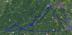 We had completed the trip, visiting 19 airports (20 if you include our return to Suffolk) in two days. We had seen everything from coast to piedmont to mountain, and returned. We covered almost 1200 total miles, including 650 the first day and another 546 the second. And through it all we maintained a congenial cockpit atmosphere with a focus on fun and safety, supporting each other with whatever information or observations were necessary as we took turns in the left seat. After our return, we took stock of our trip and neither of us felt that we had exposed ourselves to any elevated risk or unsafe situation. Our detailed planning before the trip had really paid off, giving us a confident understanding of what we were doing, where we were going and what conditions to expect along the way. Serious planning is a significant risk reducer!
When we went home that evening, we didn’t know we were going to “finish the job” the next day. We had made arrangements to get together sometime during the next day to clean up the plane and put things back in order, but did not have any flying plans. That would change!
